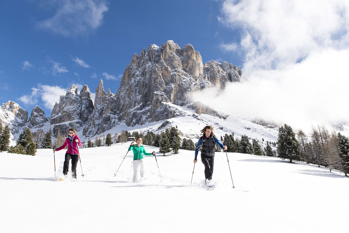
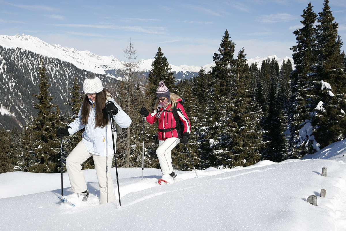
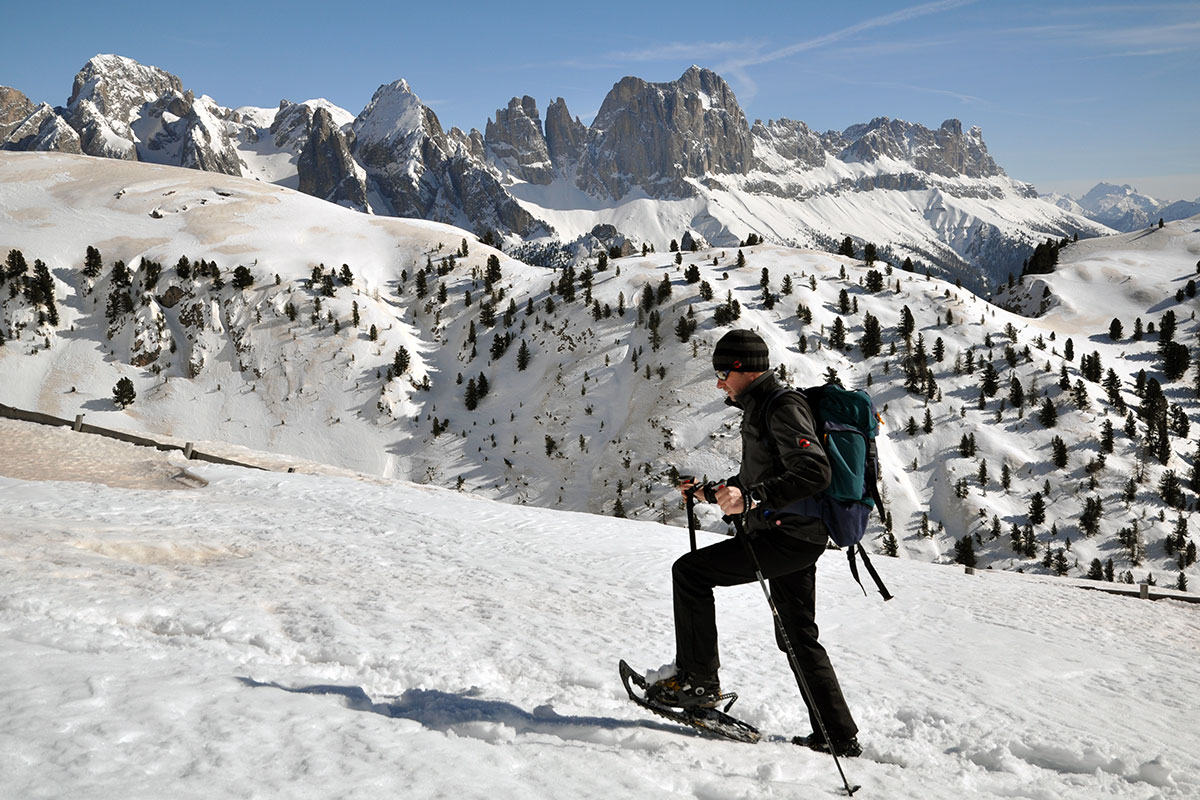
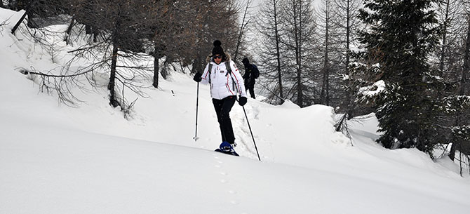
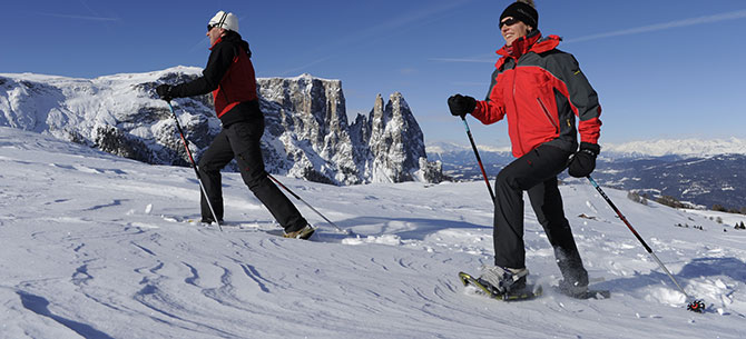
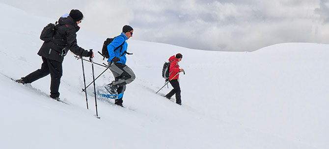
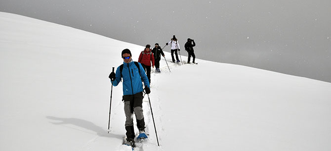
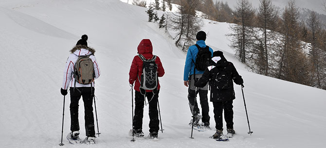
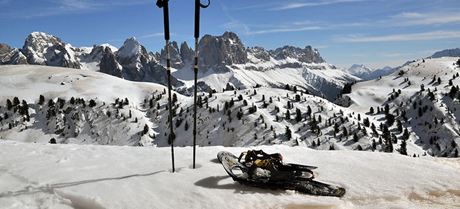
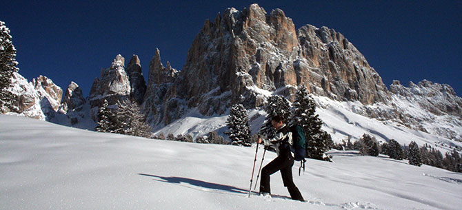
Snow-shoeing in The Dolomites
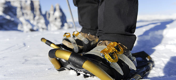
The snow-shoe is the oldest means of walking on snow. In recent years, numerous well-planned snowshoe tracks were prepared in Tiers and its surroundings. In a spectacular winter landscape you may enjoy sports, breathe the clean mountain air and enjoy a change from everyday routine. You may participate in guided walks or plan your individual tour on well-marked routes using our region’s snowshoe-map.
Through the Tschamintal/Ciamin Valley to Rechter Leger
Duration: 4 hLength: 15 km
Altitude: 630 m
Start: Berghotel Piné Bagni di Lavina Bianca/Weißlahnbad
Destination: Berghotel Piné Bagni di Lavina Bianca/Weißlahnbad
You hike directly from Hotel Piné in the Tiers/Tires valley to the "Tschamin Schwaige" and follow the road in to theTschamintal/Ciamin Valley. This road is mostly covered with snow in winter and leads up to the entry of the Tschamintal/Ciamin Valley (1380 m). Here you find a very good and highly appreciated water source, the so-called "Schwarze Lettn" (black mud). Now, the path gets narrower (1449 m) and leads to the first hut, Schaferleger Hut. The path gets a little bit steeper on the way up to Rechter Leger, but you have already reached your target. Here you are on a wide alpine meadow amidst Tschamintal/Ciamin Valley and enjoy a splendid view of the Grasleiten Peaks and Ciamin Peaks.
You return on the forest path through the Tschamin/Ciamin forest on the orthographical left side of the Ciamin River. In case of good snow conditions you can also return to the point of departure via Tschaminschwaige.
TIP:
Continuing along the path in the river bed at the bridge behind the water source is very charming.
Labyrinth path in winter
Duration: 4 hLength: 12 km
Altitude: 400 m
Start: Passo Costalunga/Karerpass
Destination: Jolanda hut at the Nigerpass road
The ski shuttle brings you to Karerpass/Passo di Costalunga (1750 m). From here you take the path crossing the Latemar meadows and leading through the forest in the direction of "Kleine Latemarscharte" below the Latemar Peaks (approx. 1960 m). After a short descent (approx. 100 m) you reach the entry to the Labyrinth path leading through huge rock blocks and rock masses and finally to an idyllic forest clearing, the Mitterleger, at 1839 m of altitude.
You can also choose another route for your return: through the popular Latemar forests down in he direction of Grandhotel Karersee to the main road. From here you follow path no. 6 via Moseralm (1580 m) and continue hiking up to Jolanda Hut (1744 m) and to Nigerpass road.
NOTE:
The labyrinth is located in a shaded area. The sun will only come out at Karerpass/Passo di Costalunga.
From Seiser Alm/Alpe di Siusi to Goldknopf
Duration: 4-5 hLength: 8 km
Altitude: 350 m
Start: Compatsch
Destination: Compatsch
Point of departure for this hike is the village of Compatsch at Seiser Alm/Alpe di Siusi, which can be reached with the cable cars from Seis/Siusi.
From Compatsch you first hike to Hotel Panorama, which can also be reached with a chairlift. You cross the alpine meadows and hike slightly downwards to Laurin Hut. Once you reach the forest road you turn left and hike in the direction of Rosszähne/Denti di Terrarossa. Then you hike to the higher Tschapitwiesen meadows and on to Goldknopf (2249 m), the highest point of Seiser Alm/Alpe di Siusi. From the ridge you hike down to Mahlknechtschwaige, a cosy hut offering great lunches.
The return path leads diagonally over the Seiser Alm/Alpe di Siusi meadows. Within 1 hour on a comfortable path you reach Compatsch and the mountain station of the cable cars.
Through the Duron Valley up to Seiser Alm/Alpe di Siusi
Duration: 5 hAltitude: 750 m
Start: Campitello di Fassa
Destination: Saltria
The road to Micheluzzi Hut is usually groomed or cleared after every snowfall, and can therefore also be done without snow-shoes. If you want to hike further into Duron Valley, you will need to put the snow-shoes on near the hut. At the end of the valley you'll enjoy a unique atmosphere. The Rosszähne/Denti di Terrarossa Mountains to the right, and Molignon Mountain to the left shine in a magical light. Further to the right you see Plattkofel/Sasso Piatto (3181 m). The deeply snowed-in Duron Valley surprises with an extraordinary panorama in the upper part of the valley.
The path continues up to Mahlknechtjoch (2168 m), a majestic viewpoint over Seiser Alm/Alpe di Siusi with a view of the Geisler Peaks and of the distant Ötztal Alps.
After crossing the mountain pass you continue to the alpine guesthouse Dialer (2054 m) where you can enjoy a break and have lunch.
From here you take the sledge or walk down to Saltria (1690 m) and the bus to Compatsch afterwards. The cable cars bring you to Seis/Siusi and the public bus back to the starting point Tiers/Tires.
From Ciampedie to Rotwand Hut
Duration: 6 hLength:8 km
Altitude: 350 m
Start:Ciampedie
Destination: Jolanda Hut at the Nigerpass road
This is a very spectacular and exciting snow-shoe hike requiring a secure step and mountain experience. In some sections you'll have to choose the route in such a way as not to be exposed to an avalanche hazard: Inform yourself about the current avalanche hazard level! For this reason we recommend booking a mountain guide for this tour.
From Vigo di Fassa (with the ski bus from Tiers/Tires) you take the modern cable cars up to the high alpine plateau of Ciampedie (1997 m). Opposite the exit you'll see the entry to the Vajolet Valley and the imposing Larsec rocks to the right. You hike in a westerly direction into the snowed-in high alpine Fassan path to Rotwand Hut (2280 m). This path is very impressive and leads through the forest and across alpine meadows over a wide band along the mountain slope. From here you enjoy a view all the way to the Fassa Valley. Due to the avalanche hazard, for the last part of the ascent to Rotwand Hut it makes sense not to take the sign-posted summer route, but to hike to the left of the valley basin.From Rotwand Hut you enjoy a vast panoramic view of the Masarè Peaks and Rotwand/Croda Rossa, to Mugoni Peak, to Fensterleturm/Torre Finestra and to the Marmolada, and even to the distant Dolomites of Cortina d'Ampezzo. The hike continues to the Theodor Christomannos Memorial (2349 m), a three metre high bronze eagle, which was realised in memorial of this tourism pioneer. From the memorial you hike down to Paolina Hut (2127 m) and take the chairlift to Karerpass road or hike down to Masarè Hut and on path no. 1C to Jolanda Hut (1744 m). The ski bus brings you back to the point of departure.
To Wolfsgrube/Fossa del Lupo and to Niger Pass
Duration: 5 hLength: 16 km
Altitude: 900 m
Start: S. Ciprian
Destination: S. Ciprian
The hike starts at Berghotel Piné in the Tiers/Tires Valley and leads to the harbour of Gemeier. There you cross a wooden bridge and follow the sign-post for "Zefaller Hof". In a steep zigzag ascent (no. 5) through the forest you reach the anticline dividing the valleys of Tiers/Tires and Eggental/Ega. Soon after, you'll reach Wolfsgrube/Fossa del Lupe, which is still well preserved. From here you hike on comfortable paths to the nearby Schillerhof, where you can have a break and enjoy some traditional food. You hike on the almost flat path no. 1 along the ridge in the direction of Rosengarten/Catinaccio and after about 1.5 hours you'll reach Niger Pass. From Niger Pass you descend to the Tiers/Tires Valley on path no. 1 and return to the point of departure.
Bärenfalle (bears' trap) and Knüppelweg Path
Duration: 7 hLength: 15 km
Altitude: 1300 m
Start: Berghotel Piné Bagni di Lavina Bianca/Weißlahnbad
Destination: Berghotel Piné Bagni di Lavina Bianca/Weißlahnbad
The ascent the other side of the Ciamin River leads through a spruce forest to the so-called Bärenfalle (bears' trap). This trail is usually snow-free, so you can do most of the ascent without snow-shoes.
Il primo punto di notevole interesse all’inizio, è il Tschetterloch, una suggestiva caverna che si presume sia stata luogo di culto preistorico. An interesting feature at the beginning of this hike is Tschetterloch, a strange rock cave with a pre-historic background. The steep ascent between rock walls up to Tschafatschsattel (2069 m) takes about 2 hours. Once you get out of the gorge you enjoy a wonderful view of the high alpine plateau of Schlern/Sciliar and of the Rosengarten/Catinaccio Mountain Group. With snow-shoes you hike down over mountain pines to Sesselschwaige (1940 m). From here you continue on Knüppelweg path through the Schlern/Sciliar gorge down to the Peter Frag wayside cross. Now you turn left on path no. 7 and reach a path leading up to Tschafon Hut (1738 m) within 45 minutes. On path 4-4a you descend to St. Zyprian/S. Cipriano and return to the point of departure.
To Hanigerschwaige
Duration: 5,5 hLength: 13 km
Altitude: 950 m
Start: S. Ciprian
Destination: S. Ciprian
Path no. 1A is sign-posted for snow-shoe hikers and starts from S. Ciprian. Niger Pass can be reached within 2 hours.
After crossing the asphalted pass road you hike in an easterly direction on a forest road (toboggan run) to the junction to Baumannschwaige. Follow the sign-posts and you'll reach an alpine meadow. The path leads to the right and steeply up to the Angelwiesen meadows within 1.5 hours. Here you enjoy a wonderful panoramic view: to the left in a southern direction you enjoy a view of Latemar and Schwarzhorn/Corno Nero and Weißhorn/Corno Bianco, opposite you, you see the Brenta Mountain Group, the Ortler/Ortles Mountain, the Ötztal and Zillertal Alps, and in front of you the Schlern/Sciliar Mountain, and behind you the Laurin Wall and the Vajolet Peaks. From the Angelwiesen meadows it's not far to Hanigerschwaige (1904 m).
The descent is not very difficult. It leads via Plafötschwiesen meadows down to the Traunwiesen meadows and back to the point of departure.

back to winter dream
Webcam
the weather a Tires
impressions
UNESCO World Heritage
