B e r g h o t e l P i n e

Loading

shape-img

Through snowy landscapes, far from the crowds

info@pine.it
0039 0471 642272

Tracks in the snow – freedom in your heart

info@pine.it
0039 0471 642272

Step by step through winter’s magic

info@pine.it
0039 0471 642272

snow-shoeing in the Dolomites

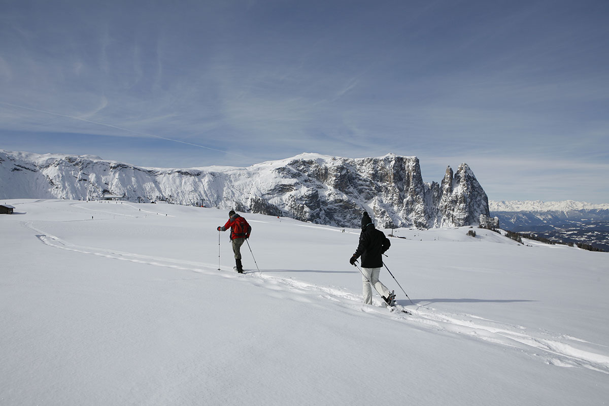
The snow-shoe is the oldest means of walking on snow. In recent years, numerous well-planned snowshoe tracks were prepared in Tiers and its surroundings. In a spectacular winter landscape you may enjoy sports, breathe the clean mountain air and enjoy a change from everyday routine. You may participate in guided walks or plan your individual tour on well-marked routes using our region’s snowshoe-map.

Schneeschuhwandern

snowshoe hikes

Duration: 4 h
Length: 15 km
Altitude: 630 m
Start: Berghotel Piné Bagni di Lavina Bianca/Weißlahnbad
Destination: Berghotel Piné Bagni di Lavina Bianca/Weißlahnbad

You hike directly from Hotel Piné in the Tiers/Tires valley to the "Tschamin Schwaige" and follow the road in to theTschamintal/Ciamin Valley. This road is mostly covered with snow in winter and leads up to the entry of the Tschamintal/Ciamin Valley (1380 m). Here you find a very good and highly appreciated water source, the so-called "Schwarze Lettn" (black mud). Now, the path gets narrower (1449 m) and leads to the first hut, Schaferleger Hut. The path gets a little bit steeper on the way up to Rechter Leger, but you have already reached your target. Here you are on a wide alpine meadow amidst Tschamintal/Ciamin Valley and enjoy a splendid view of the Grasleiten Peaks and Ciamin Peaks.
You return on the forest path through the Tschamin/Ciamin forest on the orthographical left side of the Ciamin River. In case of good snow conditions you can also return to the point of departure via Tschaminschwaige.

TIP:
Continuing along the path in the river bed at the bridge behind the water source is very charming.
Duration: 7 h
Length: 15 km
Altitude: 1300 m
Start: Berghotel Piné Bagni di Lavina Bianca/Weißlahnbad
Destination: Berghotel Piné Bagni di Lavina Bianca/Weißlahnbad

The ascent the other side of the Ciamin River leads through a spruce forest to the so-called Bärenfalle (bears' trap). This trail is usually snow-free, so you can do most of the ascent without snow-shoes. Il primo punto di notevole interesse all’inizio, è il Tschetterloch, una suggestiva caverna che si presume sia stata luogo di culto preistorico. An interesting feature at the beginning of this hike is Tschetterloch, a strange rock cave with a pre-historic background. The steep ascent between rock walls up to Tschafatschsattel (2069 m) takes about 2 hours. Once you get out of the gorge you enjoy a wonderful view of the high alpine plateau of Schlern/Sciliar and of the Rosengarten/Catinaccio Mountain Group. With snow-shoes you hike down over mountain pines to Sesselschwaige (1940 m). From here you continue on Knüppelweg path through the Schlern/Sciliar gorge down to the Peter Frag wayside cross. Now you turn left on path no. 7 and reach a path leading up to Tschafon Hut (1738 m) within 45 minutes. On path 4-4a you descend to St. Zyprian/S. Cipriano and return to the point of departure.
Duration: 5,5 h
Length: 13 km
Altitude: 950 m
Start: S. Ciprian
Destination: S. Ciprian

Path no. 1A is sign-posted for snow-shoe hikers and starts from S. Ciprian. Niger Pass can be reached within 2 hours.
After crossing the asphalted pass road you hike in an easterly direction on a forest road (toboggan run) to the junction to Baumannschwaige. Follow the sign-posts and you'll reach an alpine meadow. The path leads to the right and steeply up to the Angelwiesen meadows within 1.5 hours. Here you enjoy a wonderful panoramic view: to the left in a southern direction you enjoy a view of Latemar and Schwarzhorn/Corno Nero and Weißhorn/Corno Bianco, opposite you, you see the Brenta Mountain Group, the Ortler/Ortles Mountain, the Ötztal and Zillertal Alps, and in front of you the Schlern/Sciliar Mountain, and behind you the Laurin Wall and the Vajolet Peaks. From the Angelwiesen meadows it's not far to Hanigerschwaige (1904 m).
The descent is not very difficult. It leads via Plafötschwiesen meadows down to the Traunwiesen meadows and back to the point of departure.
Duration: 4 h
Length: 12 km
Altitude: 400 m
Start: Passo Costalunga/Karerpass
Destination: Jolanda hut at the Nigerpass road

The ski shuttle brings you to Karerpass/Passo di Costalunga (1750 m). From here you take the path crossing the Latemar meadows and leading through the forest in the direction of "Kleine Latemarscharte" below the Latemar Peaks (approx. 1960 m). After a short descent (approx. 100 m) you reach the entry to the Labyrinth path leading through huge rock blocks and rock masses and finally to an idyllic forest clearing, the Mitterleger, at 1839 m of altitude.
You can also choose another route for your return: through the popular Latemar forests down in he direction of Grandhotel Karersee to the main road. From here you follow path no. 6 via Moseralm (1580 m) and continue hiking up to Jolanda Hut (1744 m) and to Nigerpass road.

NOTE:
The labyrinth is located in a shaded area. The sun will only come out at Karerpass/Passo di Costalunga.